
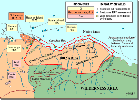
Figure 2.
Map of the ANWR 1002 area. Dashed line labeled Marsh Creek anticline marks approximate boundary between undeformed area (where rocks are generally horizontal) and deformed area (where rocks are folded and faulted). Boundary is defined by Marsh Creek anticline along western half of dashed line and by other geologic elements along eastern half of dashed line. Exploration wells are coded to show whether information from them was available for the 1987 USGS assessment of in-place petroleum resources. Dashed red line shows the offshore extent of the entire assessment area.
| Maintained by Eric A. Morrissey | http://energy.usgs.gov/factsheets/ANWR/figure2.html | Last updated 5.18.98 |